Professional Drone Mapping Solutions 30% Less Than the Leading Software
At GeoForge, we turn raw aerial data into decision‑ready insights. Powered by our TerraPilot platform and Propeller's proven technology, we deliver expert drone‑based LiDAR and photogrammetry solutions that streamline every phase of land development.
We combine professional expertise with proven Propeller technology to deliver curated solutions rather than raw platform access.
30% Cost Savings
Professional drone mapping solutions at 30% less cost than software platforms that perform similar functions, with superior local service and unlimited user access.
Expert Configuration
Professional expertise meets proven technology. We configure Propeller's platform for your specific construction, development needs.
Local Presence
Dual offices in Brooksville, Florida and Huntsville, Alabama provide regional expertise and responsive local support across the Southeast.
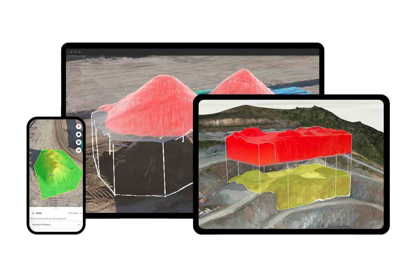
TerraPilot: Professional Solutions Platform
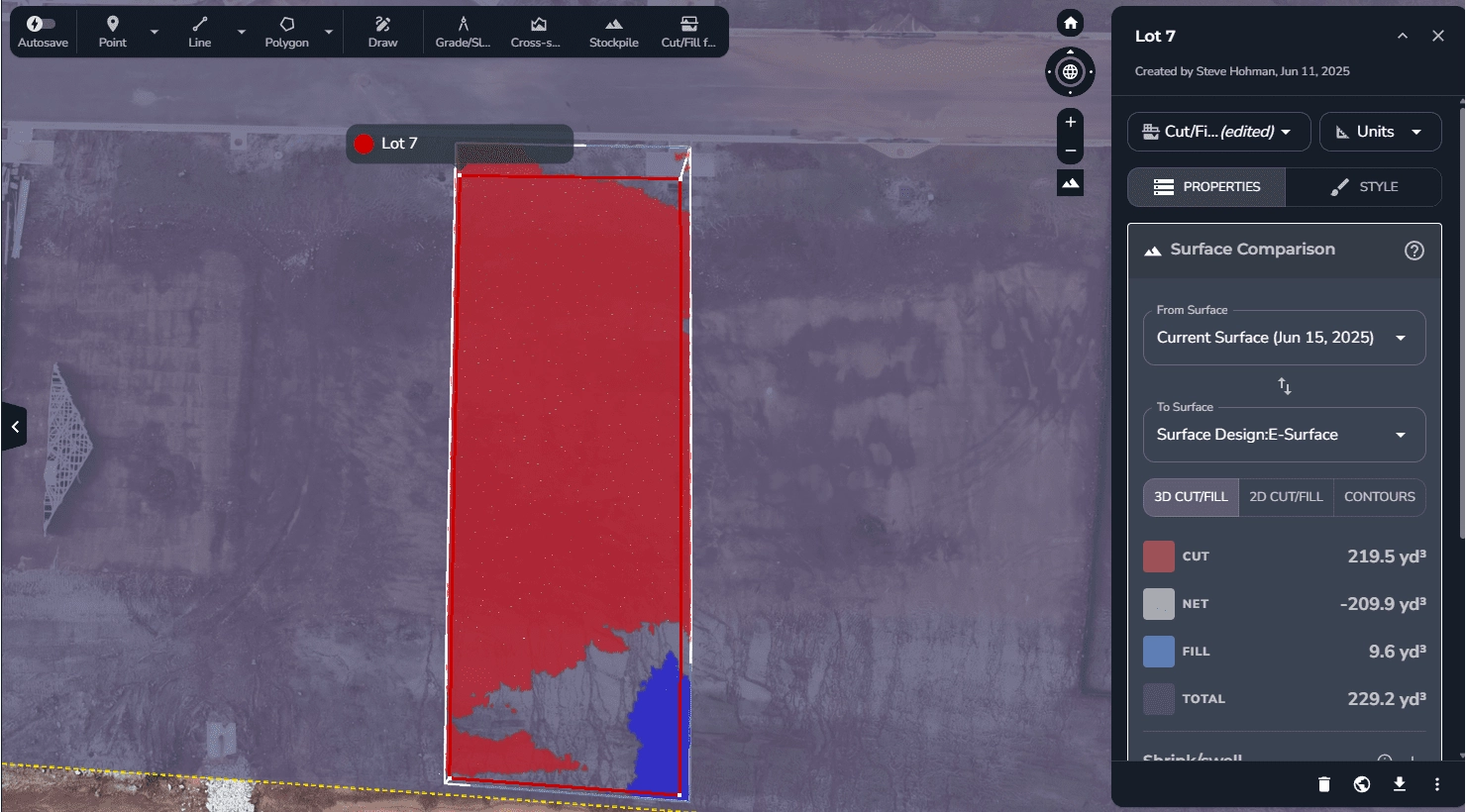
TerraPilot is GeoForge's flagship platform for turning aerial LiDAR and photogrammetry into engineer‑ready surfaces, cut/fill dashboards, and lot‑level compliance maps. Whether you build master‑planned communities or re‑grade single pads, TerraPilot keeps you on course with precision-accurate data and intuitive visual tools.
Engineer-Ready Surfaces: Professionally processed topographic data ready for CAD integration and project planning.
Cut/Fill Analysis: Real-time earthwork calculations and visual dashboards for construction progress tracking.
Compliance Mapping: Lot-level environmental and regulatory compliance documentation with professional validation.
Professional Solutions for Every Project Phase
From feasibility studies to earthworks to final close‑out, our expert-configured solutions streamline every phase of land development.
Land Development Mapping
Comprehensive site analysis for subdivisions to master-planned communities, feasibility studies, and development planning with regulatory compliance support.
Construction Progress
Real-time earthwork tracking, cut/fill analysis, and progress reporting to keep projects on schedule, within budget, and with reduced waste.
CAD Integration Services
Data processing and CAD-ready deliverables that integrate seamlessly with your existing engineering workflows. Deliverables for Trimble, Bentley, and Civil 3D.
Powered by Propeller's Proven Technology
We partner with Propeller Aero to deliver enterprise-grade drone mapping technology with professional configuration and local support. This strategic partnership allows us to focus on solution design and client service while leveraging world-class platform capabilities.
This allows us to focus on how we make the platform do what our clients need, without having to invest millions of dollars in a software solution. We can work outside the confines of the software to deliver a curated solution for each client.
We do not have millions of dollars from investors who expect a return on that investment, so we can keep our prices low while constantly driving innovation.
Experience TerraPilot in Action
See how GeoForge transforms raw aerial data into decision-ready insights. Schedule a personalized demonstration of the TerraPilot platform. To demonstrate how responsive we are, if you have a project in mind, we can gather up to 50 acres at your active site, upload your CAD design grade surface, and demo within 24 hours of data gathering. After all, is it really a demo if the data is pre-selected and groomed for a one-size-fits-all presentation?
We have found anywhere from $18,000 to $80,000 in client concerns within minutes of loading our demo. Let's see what we can find for you.
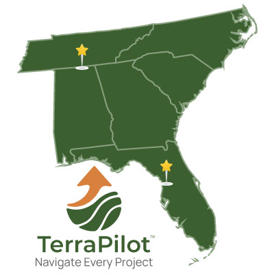
Serving the Southeast & Beyond
TerraPilot is GeoForge's flagship platform for turning aerial LiDAR and photogrammetry into engineer‑ready surfaces, cut/fill dashboards, and lot‑level compliance maps. Whether you build master‑planned communities or re‑grade single pads, TerraPilot keeps you on course with precision-accurate data and intuitive visual tools.
Brooksville, Florida: Primary location, headquarters, serving Florida, and the Southeast Coast
Huntsville, Alabama: Rapid deployment to the northern and western parts of our service area.
We keep pricing simple, and don't make you fill out a form to determine the cost of your next project. All of our plans include unlimited users in our TerraPilot™ platform, and none of our plans have a project setup fee. You can also rely on consistent pricing as our Takeoff, Climb, and Cruise packages are priced for up to 150 acres per site - no variable acreage fees.
Rapid insights gathered by LiDAR with point classification to ground, through vegetation. Great for land analysis prior to purchase, or before as-built verification during project closeout.
LiDAR data gathering, processed to ground classification and available for viewing in our TerraPilot™ portal
Perform hydro analysis, generate contours, and view ground elevation data inside TerraPilot™
Upload CAD layers for additional analysis
Download the classified LAS for downstream workflows